As tropical low 29U triggers evacuations in Bundaberg and forces Darwin's dam offline at 110% capacity, Australia's worst flooding in years exposes how climate-era weather is outpacing the infrastructure designed to handle it.
![]()
Add VegOut to your Google News feed. ![]()
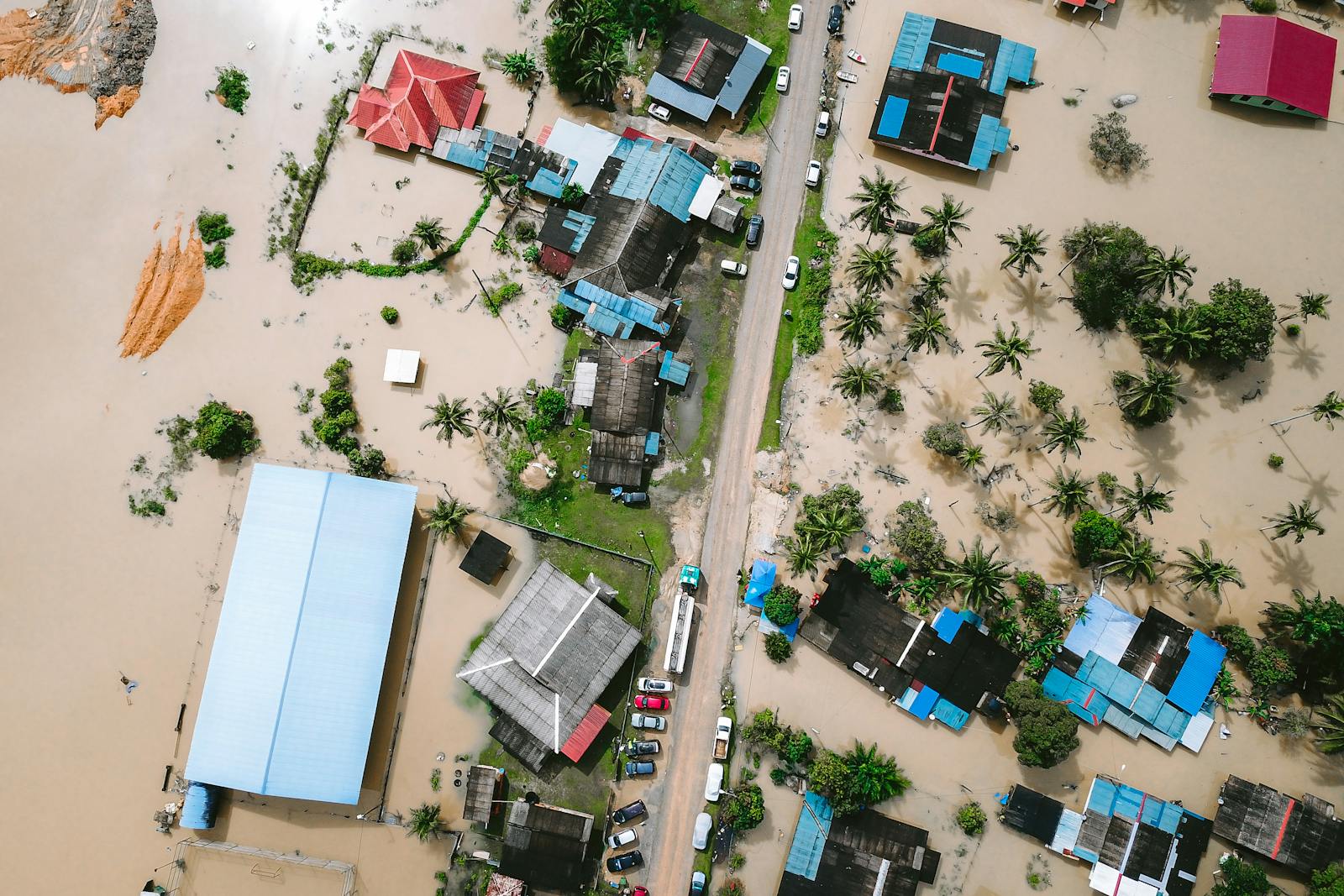
Australia's flood crisis right now is a water infrastructure story as much as it is a weather story. When a dam exceeds capacity and has to shut down entirely — leaving a capital city scrambling to conserve drinking water — the conversation shifts from emergency response to something more systemic: whether the infrastructure built for a previous climate can handle the one we're living in now.
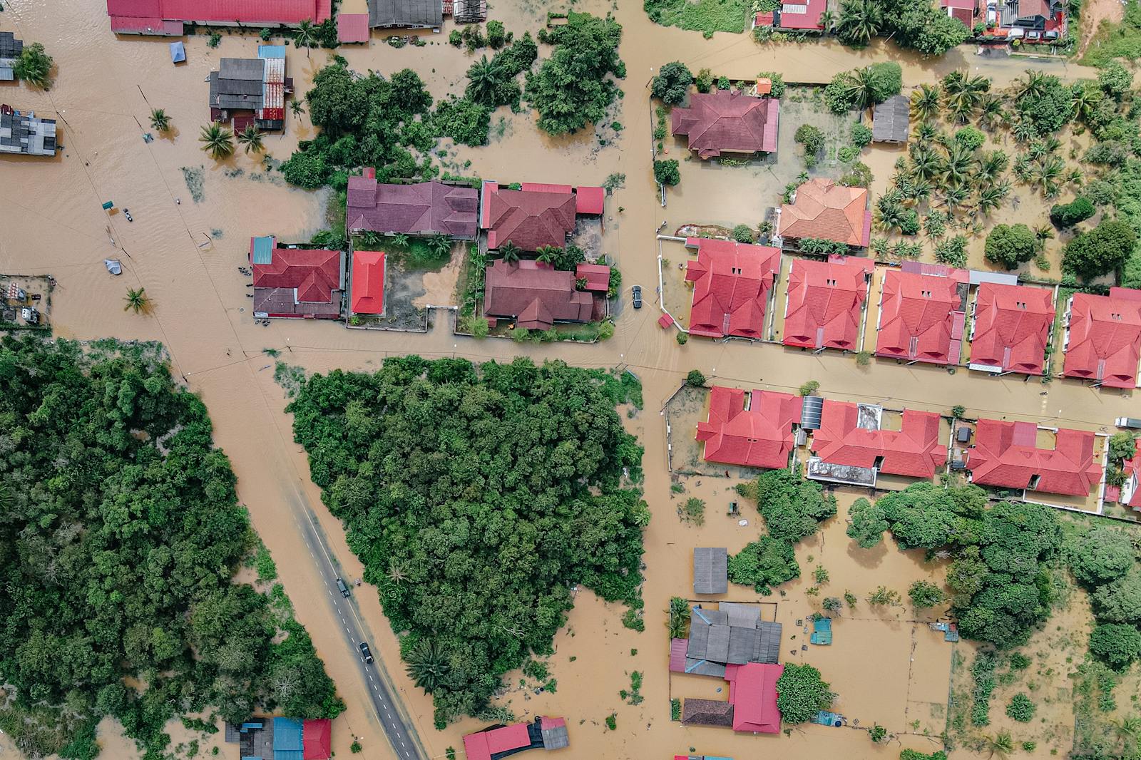
Bundaberg Under Evacuation Orders
Residents of Bundaberg, a city in southeast Queensland, have been ordered to evacuate immediately as the Burnett River is forecast to reach major flood levels by Tuesday evening. The Bureau of Meteorology warned that major flooding could worsen through the evening.
The culprit is a tropical low system, which moved inland over the weekend and dumped extraordinary volumes of rain across a massive swath of northern and central Queensland. Three-day rainfall totals from Saturday morning to Tuesday morning tell the story: significant rainfall at Boondooma, Marodian, Bundaberg South, and Gympie, according to Bureau of Meteorology data.
Those numbers translate to real danger. As of Tuesday morning, major flooding was occurring across numerous Queensland rivers, according to the Bureau.
"A very large portion of Queensland is currently in flooding, and most of the state — if they're not in flooding — they're still covered by a flood watch," said a Bureau of Meteorology spokesperson, as reported by The Guardian.
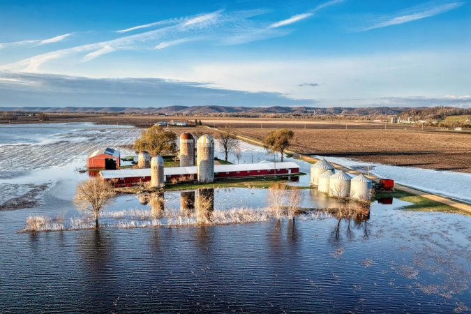
Darwin's Dam Crisis
The flooding isn't limited to Queensland. In the Northern Territory, the situation has created a paradox that captures something essential about climate-era infrastructure failures: too much water everywhere, and yet a city potentially running short of drinkable supply.
Darwin River Dam exceeded capacity after Monday's rain, forcing the facility to cease operations entirely. PowerWater, the NT's water and electricity supplier, confirmed that substantial flooding of the pump station and associated equipment shut the dam down Monday evening.
"This is an unprecedented situation and we have never seen this volume of water in the dam before," PowerWater said, according to The Guardian's reporting. Darwin residents have been asked to reduce their water usage while the dam remains offline.
Meanwhile, Katherine — further south in the NT — experienced severe flooding on Saturday and is on track for one of its wettest wet seasons ever recorded, according to Bureau data.
The Broader Pattern
None of this is happening in isolation. The 2025–26 Australian summer has been exceptionally wet, with rainfall well above the national average, according to Bureau of Meteorology preliminary data. Darwin's wet season is shaping up to be among the wettest on record.
Meteorologists have linked the severity of this event to the broader trajectory of global warming. Warmer air holds more moisture — roughly 7% more for every degree Celsius of warming — which means that when rain systems do form, they tend to dump heavier loads. Recent years have seen global surface air temperatures rise significantly above preindustrial levels, according to climate data.
The Paris Agreement's aspirational target of limiting warming to 1.5°C above preindustrial levels is effectively being approached on a yearly basis. And the downstream effects — literally — are playing out across Queensland and the Northern Territory right now.
Emergency Response and What Comes Next
Prime Minister Anthony Albanese urged residents across affected areas to heed evacuation orders and avoid floodwaters. "If it's flooded, forget it — we can't say it too many times," Albanese said, as reported by The Guardian. Multiple rescues had already been carried out across the region.
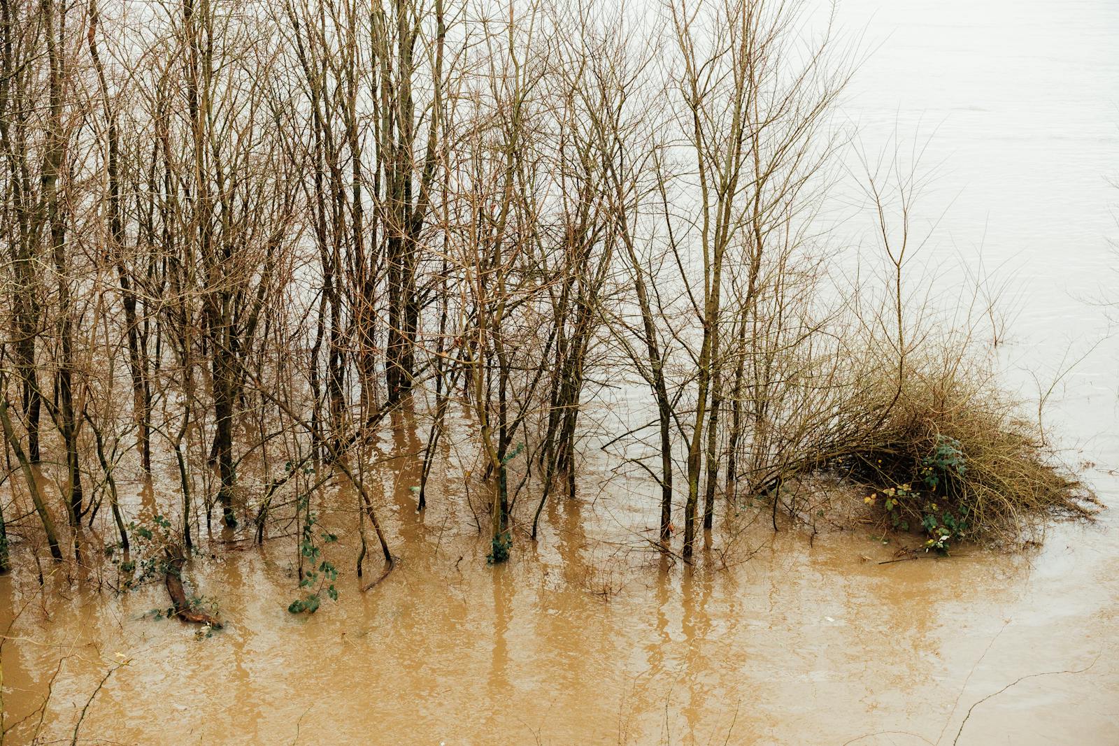
While the heaviest rain from the tropical low has largely cleared, river levels remain elevated and further rainfall is forecast through the week. That means communities like Bundaberg face a prolonged period of risk, even as the initial storm system dissipates. Floodwaters from upstream catchments take time to move through river systems, and the sheer volume spread across multiple rivers means the downstream effects will ripple outward for days.
An animated rainfall map tracking daily totals since March 7 illustrates just how widespread the deluge has been — spanning from the tropical north deep into southern Queensland.
The Infrastructure Question
The Darwin River Dam failure is a useful case study in what climate adaptation actually looks like at ground level. A dam designed to hold a certain volume of water cannot accommodate extreme overflow without cascading failures. Pump stations flood. Treatment infrastructure goes offline. A major city is told to cut back on water while surrounded by more of it than the system has ever recorded.
This is the type of compounding challenge that climate scientists have warned about for years: extreme weather events don't just create singular problems. They cascade through interconnected systems — water, power, transport, agriculture — each failure amplifying the next.
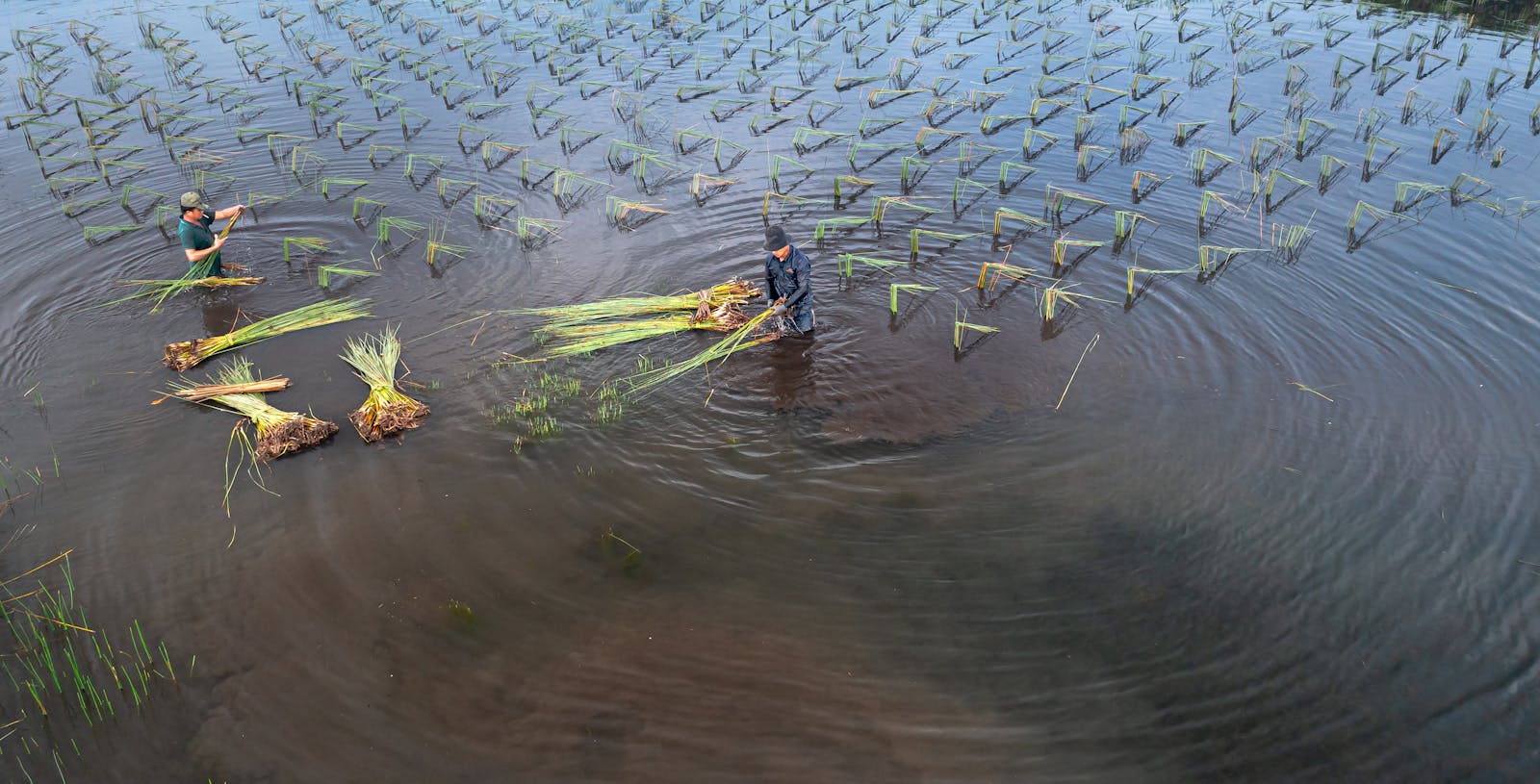
For food systems, the implications are direct. Queensland is a major agricultural producer. Flooding across multiple rivers simultaneously doesn't just displace residents; it saturates farmland, disrupts supply chains, and can compromise food safety. The full agricultural toll of this week's flooding won't be clear for weeks, but the scale of the event — affecting such a vast portion of the state — suggests the impacts on produce availability and pricing will be measurable.
The technology infrastructure that modern agriculture increasingly depends on — from sensor networks to traceability platforms — is also vulnerable to exactly these kinds of events. As VegOut has previously covered, the cloud infrastructure underpinning smart agriculture carries its own set of fragilities.
What This Means Going Forward
Australia has always been a country of weather extremes. Drought and flood have defined its agricultural cycles for centuries. But the data from this summer — significantly above-average rainfall nationwide, record dam levels, flooding across numerous rivers simultaneously — points to something beyond normal variability.
The question facing Australian policymakers, infrastructure planners, and communities is whether the systems built for 20th-century weather patterns can be adapted quickly enough for 21st-century realities. Dam capacities, levee heights, evacuation protocols, agricultural drainage — all were designed with historical baselines that are becoming less relevant with each passing year.
For now, Bundaberg residents are focused on getting to safety. The longer-term reckoning with what these events mean — and how to build resilience against their increasing frequency and severity — will follow the floodwaters.
Feature image by Tom Fisk on Pexels